A river overflowing its banks is not, by itself, evidence that nature has malfunctioned.
Flooding is part of the natural behaviour of many river systems. Water levels rise after heavy rainfall or snowmelt, spill onto floodplains and later retreat. Floods can replenish wetlands, move sediment and support ecosystems.
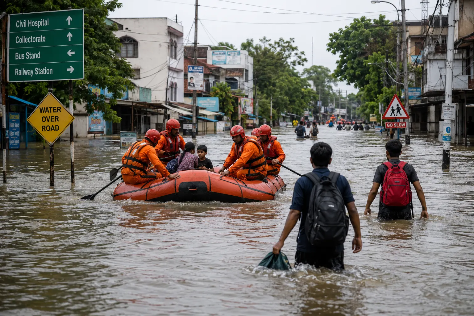
The disaster emerges when those rising waters encounter people, buildings, roads, hospitals, farms and other assets that cannot safely absorb the event.
The World Health Organization defines a flood as an overflow of water onto land that is normally dry. It identifies heavy rainfall, rapid snowmelt and coastal storm surges among the common causes.
Understanding flood risk therefore requires more than asking how much rain fell.
It requires asking where the water went and what was in its path.
The three major kinds of flooding
WHO identifies three common categories: flash floods, river floods and coastal floods.
Flash floods
Flash floods develop rapidly.
Very intense rainfall can overwhelm small rivers, drainage channels, valleys and urban drainage systems within a short period. Because water rises quickly, people have little time to evacuate.
The danger is not only depth. Fast-moving water carries tremendous force and may transport vehicles, debris, trees and parts of buildings.
River floods
River flooding generally develops when sustained rainfall or snowmelt sends more water into a river than its channel can contain.
Large river systems may rise over hours or days, sometimes offering more warning than flash floods.
But the affected area can be enormous.
Coastal floods
Coastal flooding can occur when seawater is pushed inland during storm surges associated with tropical cyclones and other severe storms.
High tide, waves and rising sea level can amplify the inundation.
Tsunamis can also flood coastal areas, although their physical origin differs from weather-driven storm surge.
Why heavy rain does not always produce the same flood
Rainfall is only the input.
The landscape determines how that water moves.
Some rain infiltrates soil. Some is intercepted by plants. Some evaporates. The remainder flows over the land into streams and rivers.
If soil is already saturated, additional rain has nowhere to go except across the surface or into waterways.
If the ground is extremely dry and hard, infiltration can also be limited.
Steep terrain accelerates runoff.
Urban areas can create particularly rapid runoff because roads, roofs and paved surfaces prevent water from soaking into the ground.
The same quantity of rainfall can therefore generate very different outcomes depending on soil moisture, topography, drainage, vegetation and land cover.
The floodplain paradox
Floodplains are attractive places to live and work.
They are often flat, fertile and located near water and transport routes. Many major settlements developed beside rivers precisely because rivers supported trade, agriculture and water supply.
But a floodplain is called a floodplain for a reason.
Development does not remove the underlying hydrology.
When homes, factories and roads expand into areas periodically occupied by water, society increases its exposure even if the probability of flooding itself stays unchanged.
WMO says flood losses have increased partly because populations and economic assets have become increasingly concentrated in flood-prone areas. It also identifies land-use change, ecosystem degradation and inadequate flood planning as important contributors to risk.
This is a crucial distinction.
An increase in flood damage does not necessarily mean floods have increased by the same proportion. There may simply be much more valuable infrastructure in harm's way.
How land-use change can intensify flooding
Changes upstream can alter what happens downstream.
Deforestation, soil degradation and urbanisation can change infiltration and runoff. Wetlands that once temporarily stored floodwater may be drained or developed.
Straightened channels and embankments may move water faster from one location while transferring risk elsewhere.
WMO notes that upstream land-use changes are among the factors contributing to rising flood damages.
None of this means natural landscapes eliminate flooding.
Rather, land management can influence how quickly water reaches rivers, how much is temporarily stored and where floodwaters spread.
Why floods kill
Drowning remains the most obvious direct danger.
WHO reports that drowning accounts for roughly three-quarters of deaths in flood disasters. Other deaths can result from trauma, electrocution, heart attacks, fire and carbon-monoxide poisoning associated with unsafe generators or damaged systems.
Flash floods are especially dangerous because of their speed.
People may attempt to walk or drive through water without realising how quickly depth and current can increase.
Vehicles offer far less protection against moving floodwater than many drivers assume.
But mortality during the initial inundation is only part of the health burden.
The health crisis can continue after the water recedes
Floodwater can mix with sewage, chemicals, fuel, agricultural waste and other contaminants.
Drinking-water infrastructure may be damaged or contaminated. Standing water can create mosquito breeding sites. People cleaning flooded buildings may encounter sharp debris, mould or hazardous substances.
WHO identifies water- and vector-borne disease, injuries, chemical hazards, disrupted healthcare, unsafe food and water, and mental-health effects among the important medium- and long-term consequences of floods.
Hospitals may themselves be flooded or lose electricity, water or road access.
A disaster can therefore increase the need for medical services while simultaneously reducing the health system's ability to provide them.
Displacement and the loss of ordinary life
Flood damage is often measured in deaths and monetary losses.
That misses part of the human impact.
Families can lose homes, identification documents, livestock, crops, tools and years of accumulated possessions in a matter of hours.
Schools may close. Jobs disappear when businesses remain inaccessible. Agricultural land can be damaged. Roads and bridges isolate communities.
Temporary evacuation can become prolonged displacement.
Mental-health effects may continue long after physical reconstruction has begun. WHO recognises both acute psychological distress and longer-term mental-health consequences as important dimensions of flooding.
The recovery period can therefore last months or years even when the flood itself lasted only days.
What climate change changes
Flooding has always occurred and has many causes.
It would be inaccurate to claim that every flood is created by climate change.
However, a warmer atmosphere can hold more moisture, creating conditions for heavier precipitation. Climate change is also raising sea levels, increasing the baseline from which coastal storm surges operate.
WHO states that the frequency and intensity of extreme precipitation are expected to continue increasing with climate change, while WMO identifies sea-level rise as an additional source of vulnerability to storm-surge flooding.
The effect varies by region, river basin and flood type.
Some locations may experience increased extreme rainfall even if average annual precipitation changes little.
The appropriate conclusion is therefore not that climate change causes all floods, but that it is altering important components of flood hazard.
Why better drainage alone cannot solve urban flooding
Cities often respond to flooding by expanding drains.
Drainage matters, but it has physical limits.
If rainfall exceeds the capacity of pipes and channels, water still accumulates. If a river is already high, drains may have nowhere to discharge. If coastal surge blocks outlets, urban water may back up.
Rapid urbanisation can also add impermeable surfaces faster than drainage networks are upgraded.
A resilient city therefore requires more than larger pipes.
Flood-sensitive urban planning may include retention ponds, restored wetlands, permeable surfaces, protected drainage corridors, floodplain zoning, raised infrastructure and well-maintained stormwater systems.
The objective is to create multiple places for water to go safely.
Can floods be prevented?
Not entirely.
Flooding is a natural hydrological process, and attempting to eliminate every flood can be prohibitively expensive or ecologically damaging.
The more practical objective is flood-risk management.
WMO's approach emphasises forecasting and warning as well as integrated management that recognises both the benefits and risks associated with floodplains.
Measures may include early-warning systems, evacuation planning, floodplain zoning, resilient buildings, embankments where appropriate, wetlands and retention areas, emergency shelters, drainage maintenance and public education.
No single measure is sufficient everywhere.
A levee may protect one district but produce catastrophic consequences if it fails. An early warning is useful only if people receive it, understand it and have somewhere safe to go.
The most important equation in flood risk
A useful conceptual model is:
Flood hazard + exposure + vulnerability = disaster risk.
The hazard is the water.
Exposure describes the people and assets located where the water may go.
Vulnerability describes how susceptible those people and systems are to harm.
This helps explain why similar floods produce radically different outcomes.
A well-prepared community with warnings, safe buildings and evacuation routes may survive a flood that becomes catastrophic in an equally exposed settlement lacking those protections.
The river matters.
So does everything society has built beside it.