Urban Heat Island Effect: Why Cities Get Hotter and How to Cool Them
The urban heat island effect describes a familiar but important feature of city life: built-up areas can become warmer than their less-developed surroundings, while some neighbourhoods within the same city can be significantly hotter than others. Walk from a shaded park into a large asphalt parking area on a sunny afternoon and the difference can be immediate. Pavement absorbs solar energy, buildings limit airflow, vegetation becomes scarce and surfaces that stored heat during the day continue releasing it after sunset.
The effect is measurable. The U.S. Environmental Protection Agency reports that, in the United States, urban areas commonly experience daytime air temperatures about 1–7°F (roughly 0.6–3.9°C) higher than outlying areas and nighttime temperatures about 2–5°F (roughly 1.1–2.8°C) higher. Those figures should not be treated as a universal rule: heat-island intensity depends on climate, weather, vegetation, building density, city size and local materials.
What makes the issue increasingly important is the interaction between local urban design and broader climate warming. Climate change raises the background temperature and contributes to more dangerous extreme-heat conditions in many regions, while the heat island adds another layer of warming created by the built environment. The IPCC identifies urban heat as an important climate risk because buildings, roads and higher background temperatures can combine to magnify exposure, affecting health, productivity and infrastructure.
Understanding the urban heat island effect therefore requires more than saying that cities contain too much concrete. Surface materials, vegetation, moisture, street geometry, building design, waste heat and the timing of measurement all influence how much heat people experience. The encouraging part is that many of those factors can be changed.
Why built-up areas become hotter
Natural landscapes manage solar energy in several ways. Trees cast shade, vegetation releases water through evapotranspiration, moist soils lose heat through evaporation, and different surfaces reflect or absorb different proportions of incoming sunlight. When development replaces vegetation and permeable ground with roofs, roads, parking areas and other hard surfaces, the way that energy is handled changes.
Material properties are particularly important. Solar reflectance, often described through albedo, determines how much incoming solar energy a surface reflects rather than absorbs. Thermal emissivity affects how effectively a material releases absorbed heat, while heat capacity influences how much energy can be stored. Dark asphalt or roofing can therefore reach temperatures far above the surrounding air when exposed to direct sunlight.
The scale of a city magnifies these individual choices. One dark roof or road is a small thermal feature; millions of square metres of roofs and pavement create a large store of heat. After sunset, some of that stored energy is released back into the urban environment. This is one reason the nighttime heat island can be particularly important even after the strongest sunshine has disappeared.
The loss of vegetation adds another mechanism. Trees and other plants cool their surroundings through both shade and evapotranspiration. EPA cites a review of 308 studies in which urban forests were, on average, about 1.6°C cooler than urban non-green areas, although actual cooling varies substantially with climate, vegetation and urban form.
Urban geometry further changes the energy balance. Streets surrounded by buildings can form what researchers call urban canyons. Buildings provide valuable shade at certain times of day, but tall structures and narrow street configurations can also restrict airflow and reduce exposure to the open sky, affecting how quickly heat escapes.
This does not mean that tall or compact cities are inevitably hotter or that low-density development is the solution. Compact development can reduce travel distances, support public transport and protect undeveloped land. The design challenge is to combine density with shade, ventilation, vegetation, suitable materials and accessible green spaces rather than treating density itself as the problem.
Cities also generate heat directly. Vehicles, industry, electrical equipment and cooling systems release waste heat into the surrounding environment. Air conditioning illustrates the tension particularly clearly: cooling indoor spaces protects people from heat, but conventional systems reject that removed heat outdoors while consuming electricity. In intensely cooled districts, this can add to local heat loads, although it is only one component of the overall urban heat island.
Better building envelopes, shading, insulation and efficient cooling systems can reduce this feedback by lowering the amount of energy required to keep interiors safe.
A heat island is not the same thing as a heat wave
Urban heat islands and heat waves are related, but they describe different phenomena.
A heat wave is a period of unusually hot weather relative to the conditions normally expected in a particular place and season. It is primarily a meteorological event and can affect cities, suburbs and rural areas simultaneously.
An urban heat island, by contrast, is a spatial temperature difference associated with the built environment. It describes how developed areas or particular urban neighbourhoods can be warmer than surrounding or nearby areas because of land cover, materials, vegetation, geometry and human activity. EPA explicitly distinguishes the two phenomena while noting that they can compound one another.
The interaction is what creates particular concern. A city may already have warmer nighttime conditions than nearby areas because stored heat is being released from buildings and pavement. When a regional heat wave raises temperatures further, residents can face both the meteorological extreme and the local urban temperature penalty at the same time.
Nighttime conditions are especially important because cooler nights normally give bodies, homes and infrastructure some opportunity to recover from daytime heat. If an urban neighbourhood remains hot after sunset, people without effective cooling may experience prolonged exposure rather than a meaningful thermal break.
Climate change adds a third layer. It is not itself the cause of the urban heat island—the phenomenon existed before modern global warming—but rising temperatures can increase the severity of heat exposure in already-hot urban environments. EPA similarly treats climate change and heat islands as interacting risks rather than interchangeable concepts.
This distinction matters for policy. Cutting greenhouse-gas emissions is necessary for limiting long-term climate warming, but it will not by itself eliminate existing local heat islands. Planting trees, changing roofs, improving public shade and redesigning streets can reduce local heat exposure, but those actions do not replace global climate mitigation. Cities need both.
Surface temperature is not the same as the air people feel
Urban heat is often communicated through colourful satellite maps showing intensely hot roads, roofs and industrial areas beside much cooler parks or water bodies. These images can be extremely useful, but they require careful interpretation.
Satellites commonly measure land-surface temperature: the thermal conditions of roofs, roads, soil, vegetation and other exposed surfaces. A road exposed to direct sunlight can become dramatically hotter than the air above it, while a shaded lawn or tree canopy may remain much cooler. Surface maps are therefore valuable for identifying materials and land-cover patterns that absorb large amounts of solar energy.
But people do not experience surface temperature alone. Air temperature, humidity, radiation, wind, shade, clothing, activity and other factors all influence human heat exposure. EPA notes that air-temperature observations are particularly useful for assessing public-health risk because they more closely represent the conditions people actually encounter within the urban canopy.
Surface and atmospheric heat islands also behave differently over time. Surface contrasts can be especially dramatic during sunny daytime conditions as roofs and pavements heat rapidly. Atmospheric heat islands can become particularly important after sunset, when stored energy from urban materials continues warming the air.
That is why one satellite image should not be treated as a complete heat-risk map.
A stronger urban heat assessment combines several kinds of evidence. Satellite observations can provide broad spatial coverage and identify hot surfaces. Fixed weather stations and mobile sensors can measure air temperatures. Tree-canopy data reveal shade distribution, while building and demographic information can show where residents may have limited access to safe cooling.
Timing matters as well. A neighbourhood that appears extremely hot on a daytime surface map may cool substantially at night, while another area may retain dangerous heat long after sunset. Measuring both day and night produces a more useful picture than relying on a single afternoon image.
The larger point is methodological: measure the kind of heat that corresponds to the problem being solved. If the objective is identifying roofs suitable for reflective materials, surface-temperature data may be highly useful. If the objective is protecting residents from heat-related illness, local air temperature and human vulnerability become essential.
Why urban heat becomes a health, energy and infrastructure problem
Higher city temperatures are not simply a matter of discomfort. Heat exposure can contribute to heat exhaustion, heat stroke and heat-related mortality, while also worsening some existing medical conditions. EPA identifies elevated urban temperatures as a factor that can increase heat-related illness and death and worsen quality of life.
Risk is not distributed evenly. Older adults, infants, people with certain health conditions, people working outdoors and households without reliable access to safe cooling can face greater exposure or vulnerability. Housing quality, income, tree cover, working conditions and access to healthcare or cooled spaces can all influence the consequences of the same weather event.
Heat also affects energy systems. Hotter outdoor conditions increase demand for air conditioning, often at the same time across large sections of a city. Electricity networks can therefore experience some of their greatest loads during extreme heat. Higher cooling demand increases household bills and, where electricity generation relies on fossil fuels, can also contribute indirectly to additional greenhouse-gas and air-pollution emissions.
Infrastructure is affected as well. Extreme surface temperatures can accelerate deterioration of some pavement and building materials. Hot stormwater flowing across heated roads and parking areas can raise the temperature of receiving water bodies. Public spaces without sufficient shade can become uncomfortable or unusable during parts of the day, discouraging walking, cycling and outdoor activity.
There is also an economic dimension. Outdoor workers can face reduced safe working time and greater health risk, while overheated buildings can reduce comfort and productivity. At a larger scale, extreme heat can interact with power systems, transport infrastructure and emergency services.
These effects explain why urban heat should not be treated as a narrow environmental-design issue. It intersects with public health, energy, transport, housing, labour and social policy.
Why some neighbourhoods are hotter than others
Calling the phenomenon an “urban heat island” can create the impression that an entire city is uniformly warmer than the surrounding countryside. In reality, cities often contain many local hot and cool zones.
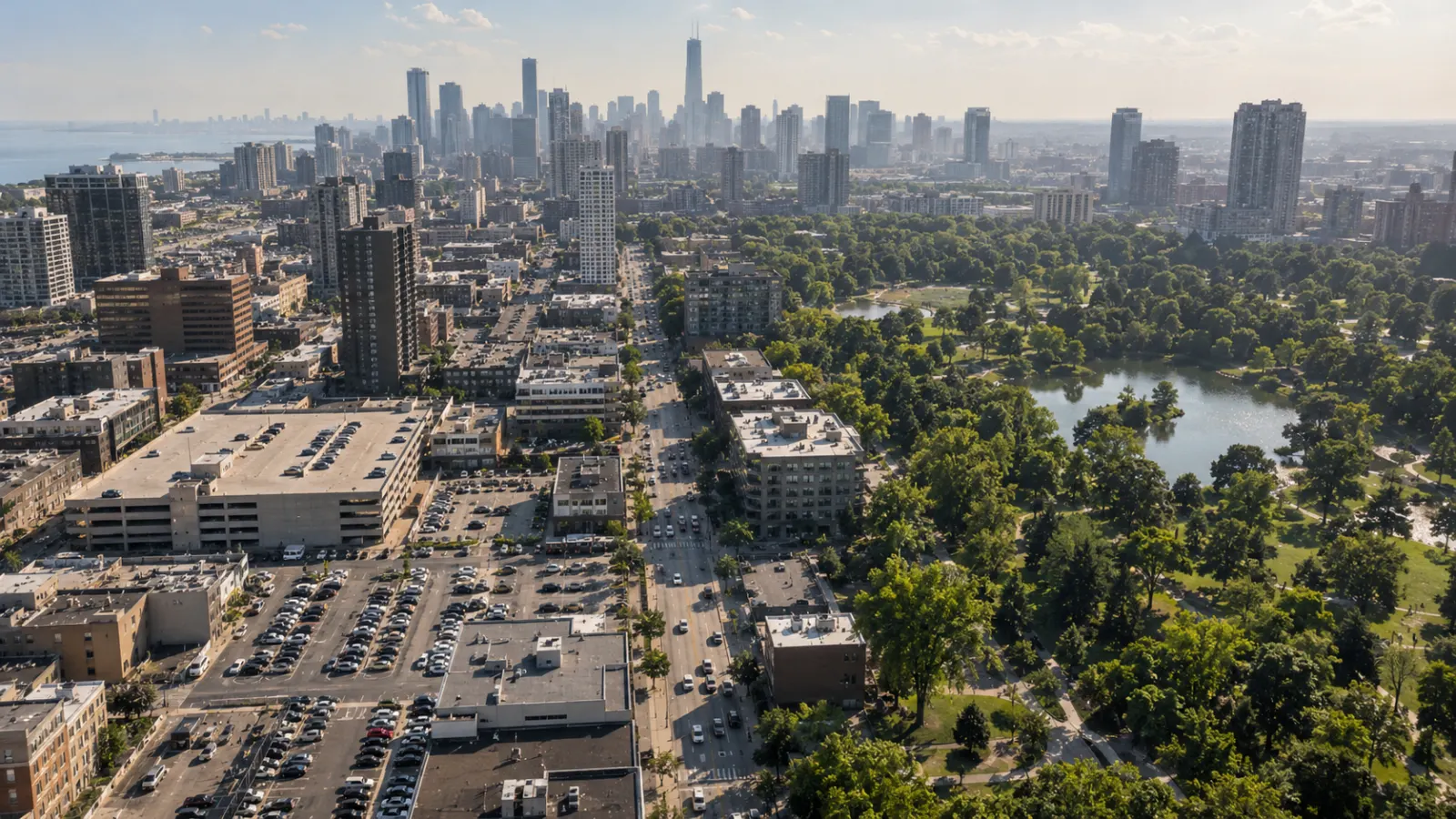
A park with mature trees may be substantially cooler than an adjacent commercial area dominated by roofs and parking surfaces. Two residential neighbourhoods only a few kilometres apart can differ in canopy cover, housing materials, road width, access to parks and exposure to industrial land. These differences can produce meaningful variations in temperature and in residents' ability to cope with that heat.
Historical patterns of planning and investment can contribute to those differences. Areas with less vegetation, more paved land, poorer housing and fewer public spaces may experience greater heat exposure, while wealthier districts can have mature trees, irrigated landscapes and buildings with reliable cooling. The result is that heat risk can overlap with existing social vulnerability.
This is why citywide averages can be misleading. An average temperature may describe no neighbourhood particularly well. Heat planning becomes more effective when data are collected and analysed at the scale at which people actually experience the problem.
The original draft correctly emphasises this point: effective mapping can combine temperature with information such as age, income, housing quality, outdoor work, transit dependence and access to trees or cooling. The objective is not simply to find the city's hottest surface. It is to identify places where high exposure and high vulnerability overlap.
That distinction changes investment priorities. A tree-planting programme measured only by total number of trees may appear successful while providing little relief to residents on the hottest pedestrian routes. Cooling infrastructure placed where it is already relatively comfortable may produce less health benefit than shade installed around schools, bus stops, clinics or heavily used walking routes in high-risk neighbourhoods.
Maintenance must also be considered. A newly planted tree does not provide the same shade as a mature tree, and trees that die because of inadequate soil or water provide no long-term cooling. Cooling centres are useful only if residents can reach them, know they exist and can use them during dangerous conditions.
Heat equity therefore involves more than distributing projects equally. It means targeting interventions according to exposure, vulnerability and practical access.
Trees, roofs, pavements and shade cool cities in different ways
There is no single technology capable of eliminating urban heat. Different interventions work through different physical mechanisms and suit different urban conditions.
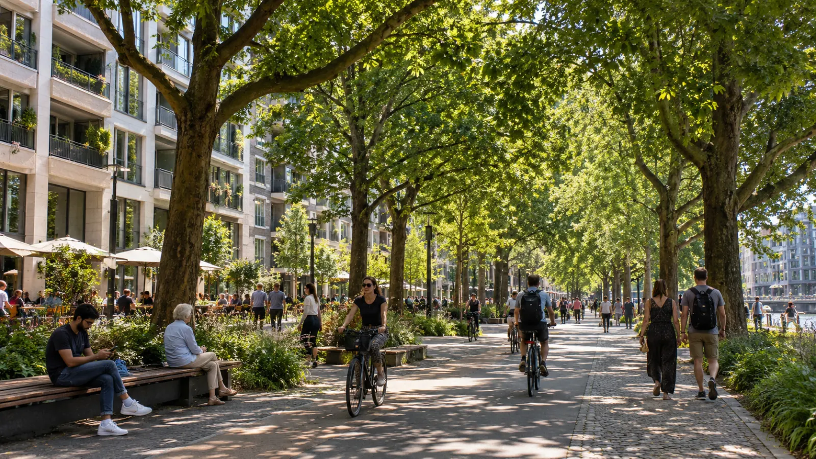
Trees and vegetation cool through shade and evapotranspiration. Street trees can reduce direct solar exposure for pedestrians and buildings, while parks and vegetated corridors can create broader cooler areas. Their benefits extend beyond temperature to stormwater management, habitat and public-space quality. But trees need adequate soil, water, species selection and long-term maintenance; planting large numbers without planning for survival is not an effective heat strategy.
Green roofs introduce vegetation where ground-level space is limited. They can shade roof surfaces, cool through evapotranspiration and provide stormwater and habitat benefits. EPA reports substantial reductions in roof-surface temperatures compared with conventional roofs, although actual performance varies with design, climate, vegetation and water availability. Structural capacity, waterproofing and maintenance can limit where they are practical.
Cool roofs use materials with high solar reflectance and suitable thermal emittance so that less incoming solar energy is retained by the building. EPA notes that they can reduce roof temperature, cooling demand and surrounding heat, especially in warm sunny climates. Their costs and benefits depend on climate, insulation, roof type and building use.
Cool pavements seek to reduce heat stored in streets, parking areas and other paved surfaces through reflective materials, evaporation or other approaches. EPA describes the category as a mixture of established and emerging technologies rather than one standard material. Performance must also be assessed beyond surface temperature: glare, pedestrian comfort, durability, stormwater and local climate can all matter.
Shade structures can provide immediate relief at highly exposed places such as transit stops, playgrounds and pedestrian routes. Unlike trees, they do not require decades of growth, although they also lack many of vegetation's environmental benefits.
Buildings themselves can reduce heat exposure through external shading, insulation, ventilation, efficient cooling and design that limits unnecessary solar gain. Reducing a building's cooling demand can also lower the amount of waste heat and electricity demand associated with air conditioning.
The strongest urban heat strategies usually combine these approaches rather than searching for a single citywide solution. EPA's current heat-island guidance similarly presents trees, green roofs, cool roofs, cool pavements and heat adaptation as complementary measures.
The goal is not to remove urban heat completely
Cities cannot be made thermally identical to forests or undeveloped landscapes. Buildings, roads and human activity will always alter local energy flows. Climate change will also continue influencing the background temperatures against which urban heat occurs.
The practical objective is therefore to reduce avoidable local warming and reduce the harm caused by the heat that remains.
That begins with measurement. Cities need to know where daytime surfaces become hottest, where nighttime air remains warm, where tree canopy is scarce and where people have the least capacity to avoid exposure. The answer may differ block by block.
It also requires recognising that urban heat is partly the cumulative result of thousands of individual design decisions. Every roof has a solar response. Every road affects heat storage. Every tree changes shade and evaporation. Building height and orientation affect wind and radiation. Parks, courtyards and water-sensitive landscapes alter the local thermal environment.
When those decisions are made independently, hot neighbourhoods can emerge almost accidentally. When temperature is treated as an explicit planning variable, cities can design for shade, ventilation, vegetation, reflective surfaces and lower cooling demand from the beginning.
The urban heat island effect is therefore not only a warning about cities. It is also a design signal.
Cities generate their own local climates, but those climates are not completely fixed. The materials used on roofs and streets, the amount and location of tree canopy, the design of buildings, access to cooling and the distribution of public investment can all influence how much heat people experience.
Urban heat cannot be designed away entirely. A substantial part of it, however, can be designed down—and the greatest benefit will come when cooling is directed first to the places where high temperatures and human vulnerability meet.